Blog · Training Tips
How to Read the Weather for a Redlands Flight
Getting the weather for a Redlands flight takes one extra step, because Redlands Municipal (KREI) has no official weather station of its own. The FAA's airport listing points pilots to nearby reports instead. Once you know which ones to read, and how to read them, it's quick.
For any flight that leaves the vicinity of the airport, 14 CFR 91.103 requires the pilot in command to become familiar with the weather reports and forecasts. Here's how to do that well.
Where Redlands' weather comes from
- San Bernardino International (KSBD), about four nautical miles west, is the closest official report. It issues METARs and a TAF, and its digital ATIS is on 124.175.
- Riverside Municipal (KRAL), about 17 nautical miles southwest, reports METARs; its ASOS broadcasts on 128.8.
- Ontario (KONT) and March Air Reserve Base (KRIV) issue TAFs, useful for the wider picture.
- The automated UNICOM at Redlands. Click your mic three times on 123.05 for an automated weather and airport advisory.
Redlands sits about 400 feet higher than San Bernardino and closer to the mountains, so treat San Bernardino's report as a very good neighbor, not as Redlands itself. Wind in particular can differ between the two.
Reading a METAR
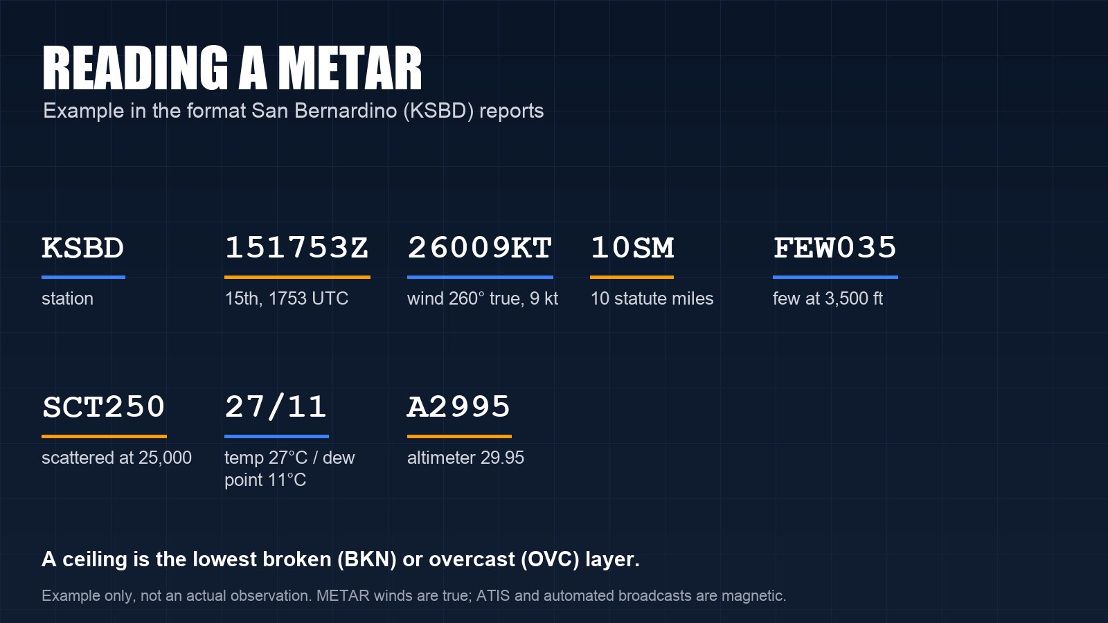
A METAR is a routine observation. Here's an example in the format San Bernardino uses:
KSBD 151753Z 26009KT 10SM FEW035 SCT250 27/11 A2995 RMK AO2
- KSBD: the station.
- 151753Z: the 15th of the month at 1753 UTC. Pacific Daylight Time is UTC minus 7 hours, so that's 10:53 a.m. In winter, Pacific Standard Time is UTC minus 8.
- 26009KT: wind from 260 degrees at 9 knots. METAR winds are referenced to true north, while runway headings and spoken ATIS or automated broadcasts use magnetic. Around Redlands the difference is more than 10 degrees.
- 10SM: visibility 10 statute miles.
- FEW035 SCT250: a few clouds at 3,500 feet above the ground and scattered clouds at 25,000. Neither is a ceiling. A ceiling is the lowest broken (BKN) or overcast (OVC) layer, or a vertical visibility into an obscuration.
- 27/11: temperature 27°C, dew point 11°C. A small spread between the two means moisture: think fog, low clouds and carburetor ice.
- A2995: altimeter setting 29.95 inches.
- RMK AO2: remarks; AO2 means an automated station with a precipitation sensor.
Reading a TAF
A TAF is a forecast for the area within five statute miles of the airport. An example:
KSBD 151720Z 1518/1618 VRB05KT P6SM SKC FM160200 27010KT P6SM SKC
- 151720Z: issued on the 15th at 1720 UTC.
- 1518/1618: valid from the 15th at 1800 UTC to the 16th at 1800 UTC.
- VRB05KT P6SM SKC: variable wind at 5 knots, visibility more than 6 statute miles, sky clear.
- FM160200: from the 16th at 0200 UTC, which is 7 p.m. local on the 15th in summer, the wind becomes 270 degrees at 10 knots.
Watch for TEMPO (temporary changes) and PROB30 or PROB40 (a 30 or 40 percent chance), and for a WS group, which means low-level wind shear.
The rest of a good briefing
- AIRMETs. Sierra covers IFR conditions and mountain obscuration, Tango covers turbulence and strong surface winds, and Zulu covers icing.
- Winds aloft forecasts for the altitudes you'll fly, especially near the passes and the mountains.
- PIREPs from pilots who have been up.
- Graphical Forecasts for Aviation on aviationweather.gov for the regional picture of clouds, visibility and weather.
- The NWS Area Forecast Discussion from the San Diego office, which covers the Inland Empire. Forecasters explain their reasoning there, often days ahead.
- NOTAMs and TFRs, which aren't weather but belong in the same briefing.
You can get a standard briefing from Flight Service by phone at 1-800-WX-BRIEF or online at 1800wxbrief.com.
Do the density altitude math
The METAR gives you what you need. As a rule of thumb, density altitude goes up about 120 feet for every degree Celsius above standard temperature. At Redlands' elevation of 1,574 feet, standard temperature is about 12°C. On a 35°C afternoon with a standard altimeter setting, that's about 23 degrees above standard, so the density altitude is roughly 1,574 + 2,760, or about 4,300 feet. Your airplane's performance charts will show what that does to your takeoff roll and climb.
Local patterns worth knowing
- Marine layer mornings can put low clouds over the coast, and sometimes the inland valleys, while Redlands is clear.
- Santa Ana winds bring gusty northeast winds, turbulence near the passes and wildfire risk, mostly from October through March.
- Summer heat raises density altitude, and afternoon winds often pick up through the passes.
- Mountain weather can differ sharply from the valley. Big Bear City (KL35) reports METARs and gives a sense of conditions up high.
Learn it with an instructor
Reading weather well is a skill you build one briefing at a time. Ask your instructor to go through the real briefing with you before a lesson, and before long it becomes a habit rather than a chore.
Cornerstone Flight Academy trains and rents at Redlands Municipal Airport. Call or text (909) 330-4748, or visit flycornerstone.com.
Book a $120 intro flight · Aircraft rental and time building · Pilot training at Cornerstone · More from the blog